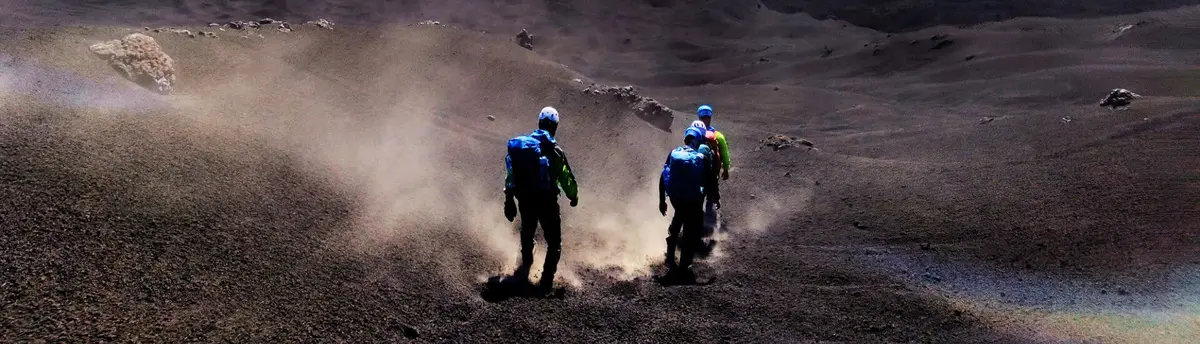
Etna North or South Side? Where I Work as a Guide — and Why
Piano Provenzana or Rifugio Sapienza? I work on both sides of the volcano, almost every week. Here is where each of my tours starts — and how I would choose in your place.
North or south side of Etna — my short answer
I guide on both sides of Etna. My Summit Craters tour uses the north around Piano Provenzana; Sartorius is in the north-east. Cable Car & 4x4 uses the south at Rifugio Sapienza. Choose by the published programme and current conditions, not a promise that one side is always better.
The south has the cable-car infrastructure and open volcanic slopes. The north offers forest approaches and terrain shaped by the 2002 eruption. Visitor numbers vary: a private booking means a dedicated guide, not an empty trail or exclusive access.
Which side do I choose for each of my tours?
From Piano Provenzana — the north side (1,800 m)
Piano Provenzana is the small tourist station that the 2002 eruption destroyed and that was rebuilt among its own lava. It is where most of my proper walking begins:
- The summit craters. My summit craters trek from Piano Provenzana rides the 4x4 to 2,900 m, then continues on foot into the summit crater zone at around 3,300 m — always within the maximum altitude allowed by the ordinances in force, on a volcano whose top stands at about 3,400 m. I run this day from the north because the approach over Piano delle Concazze is quieter and, to my eye, more dramatic: the craters grow in front of you with the sea far below at your back.
- The 2002 craters. The retired trek across the craters of the 2002 eruption explores the northern vents; the 2002–2003 eruption also affected the southern flank. Walking the Bottoniera craters with someone who can read them is the clearest lesson I know in what a flank eruption does.
- Families. For families with children and anyone who wants a real volcanic landscape without a long climb, the Monti Sartorius walk is just around the corner from here, on the north-east flank above Linguaglossa.
From Rifugio Sapienza — the south side (1,910 m)
The southern programme combines cable car, 4x4 and about 90 minutes walking at altitude. Transport reduces the ascent on foot but does not remove the route’s physical or health requirements.
- Cable car + 4x4 + walk. The current private tour starts at Rifugio Sapienza: cable car from about 1,900 to 2,500 m, then 4x4 to around 2,900 m and approximately 1 h 30 on foot. Return is by 4x4 to 2,500 m and cable car to 1,900 m. Allow about 3 hours in total; a lava cave is not a scheduled stop on this itinerary.
- Transport plus walking. My southern tour costs €300 per private group up to six plus €82 per person for the listed mountain transport. It lasts about three hours, including approximately 90 minutes walking, from age six.
- Lower paths. Check current access measures and local signs even around Rifugio Sapienza and the Silvestri craters. A lower altitude does not automatically mean unrestricted access.
Choose one of my three private excursions: Summit Craters, Cable Car & 4x4, Monti Sartorius. Snowshoeing, night excursions, cave visits and wine tastings are past offers and are not currently bookable, including on request. This article remains as destination information. Current private excursions.
What actually changes between the two sides?
The landscape
The south side is open and panoramic: recent lava all around, the cable car line climbing above you, and that constant, almost aerial view over the Valle del Bove and the coast around Catania. The north side is more layered — you rise out of pine forest into the black 2002 lava, past hornitos and craters that still look like the day they cooled. If I had to put it in one line from the field: the south shows you how big the volcano is, the north shows you what it does.
The crowds
Expect visitor numbers to change with season, departure time and conditions. Both gateways and the walking routes can be busy. Choose the programme for its content and requirements rather than a guarantee of solitude.
The weather
Weather and visibility can differ between flanks and elevations. Check the forecast, dated INGV bulletins and applicable restrictions. Webcams show only their frame and displayed time; cloud or an interrupted feed can hide conditions. They do not establish that a route is suitable or open.
So, which side of Etna is better?
It depends on what you are coming for — and I mean that as a real answer, not a diplomatic one:
- Summit objective. My northern summit trek is the most demanding of the three programmes, from age 12. The actual route depends on restrictions and conditions; a guide cannot override a closure.
- Walking requirements. Cable Car & 4x4 still requires around 90 minutes on volcanic terrain at altitude. Do not choose it solely because a visitor has knee problems or is travelling with young children.
- You want the volcano quiet, with the 2002 story under your boots. North, without hesitation.
- A shorter walk. Sartorius, from age five, has an approximately 4 km full circuit with about 100 m of ascent, adapted within the published 1–3 hour programme. It is not a flat path.
- You cannot decide. Do what many of my guests do: south one day for the cable car and the Valle del Bove, north another day for the trek. The volcano rewards both, differently.
Still unsure? Write to me with your dates and who is coming — matching people to the right side of this mountain is, quite literally, my job. Or browse all my Etna excursions and see which day speaks to you.
Sources and official references
- INGV — Osservatorio Etneo — official monitoring and bulletins on volcanic activity.
- Parco dell'Etna — protected-area rules and trail access.
- Funivia dell'Etna — cable car tariffs and opening hours.
- Guide Alpine e Vulcanologiche della Sicilia — the licensed guiding body.
Before You Book: Quick Planning Checklist
- Check updated weather and volcanic activity conditions for your travel dates.
- Check the mountain meeting point and the departure time in the calendar. Travel independently with your rental car; no transfer is provided.
- Compare routes, practical details and availability, then use the booking calendar on your chosen tour page.
- Read local safety guidance before excursions.